Toggle menu

Local Geodiversity Sites in West Lothian

West Lothian's landscape has developed and been shaped over millions of years, by geological processes and by people. West Lothian's Local Geodiversity Sites have been selected to represent the variety of landscapes, landforms and rock features of the area.

The bedrock of this area formed during the Carboniferous Period (299-359 million years ago) and comprises both sedimentary and igneous rocks. Igneous rocks are the result of volcanic activity and the underground intrusion of magma. They are resistant to erosion and tend to form hills and high ground. In contrast, most of the low-lying areas are underlain by sedimentary rocks, which include limestone, coal, sandstone, mudstone and oil shale. 

For most of the last 300 million years, this area has been high ground, gradually being eroded by natural processes with rivers running eastwards towards the North Sea. During the Quaternary Ice Age of the last two million years, West Lothian has been covered by ice several times. These ice sheets have flowed from high ground to low ground, travelling west-east across the area, shaping the landscape and depositing glacial till, sand and gravel as they melted.

Many recent changes to the landscape have occurred from West Lothian's long history of mineral production. A wide range of materials have been produced, including coal, oil, limestone and building stone, and mining and related industries have had an impact on the county's character.
Further information about all aspects of West Lothian's geodiversity can be found from the West Lothian Geodiversity report [596KB] produced by the British Geological Survey in 2006.

Please note that some of the Local Geodiversity Sites are also designated as Sites of Special Scientific Interest (SSSI), or as Scheduled Monuments. It is an offence for anyone to intentionally or recklessly damage these protected natural features. On nationally protected sites, collecting is not allowed without the permission of NatureScot or West Lothian Council.

A geology leaflet bringing together a number of local geodiversity sites across the Bathgate Hills has been put together through the Lothian & Borders Geo-conservation Group that comprises expert geologists and other interested parties  The Bathgate Hills Geotrail [3MB]   Copies of this leaflet are also available from Beecraigs Country Park visitor reception.

For more information on specific sites, click on any of the Local Geodiversity Sites listed below or find the site from the map (opens new window).

Geodiversity sites
1. Baad Park Burn in the Pentland Hills2. West Cairn Hill in the Pentland Hills3. Linhouse Water
5 Five Sisters Shale Bings near West Calder
6 Seafield Law-east of Easter Inch Moss Blackburn
4. East Kirkton Quarry5. Five Sisters Shale Bings6. Seafield Law
7 Greendykes Bing complex between Broxburn and Winchburgh
8 Almond Valley Heritage Centre in Livingston
9 Murieston Water by Calderwood Country Park
7. Greendykes Bing complex8. Almond Valley Heritage Centre9. Murieston Water
10 Almondell and Calderwood Country Park
11 Upper Uphall
12 Union Canal in Winchburgh
10. Almondell and Calderwood Country Park11. Upper Uphall12. Union Canal in Winchburgh
13 Hopetoun Obelisk Quarry Hopetoun Estate
Society East Shore at Hopetoun near South Queensferry
15 Society Point at Hopetoun near South Queensferry
13. Hopetoun Obelisk Quarry14. Society East Shore at Hopetoun15. Society Point at Hopetoun
16 Society Shore at Hopetoun near South Queensferry
17 Hopetoun Shore near Hopetoun House by South Queensferry
18 Abercorn Point near Hopetoun House by South Queensferry
16. Society Shore at Hopetoun17. Hopetoun Shore near Hopetoun House18. Abercorn Point near Hopetoun House
19 Midhope Burn south west of Hopetoun House
20 Cairnpapple Hill in Bathgate Hills
21 Wairdlaw Quarry south of Beecraigs Country Park Bathgate Hills
19. Midhope Burn20. Cairnpapple Hill in Bathgate Hills21. Wairdlaw Quarry
22 Union Canal Museum Linlithgow
23 Levenseat working quarry south of Fauldhouse
24 Levenseat quarries and mines south of Fauldhouse
22. Union Canal Museum, Linlithgow23. Levenseat working quarry, south of Fauldhouse24. Levenseat quarries & mines, south of Fauldhouse
25 Skolie Burn by Addiewell
26 Petershill Quarries north east Bathgate
27 Rifle Range Quarries Bathgate Hills
25. Skolie Burn by Addiewell  26. Petershill Quarries27. Rifle Range Quarries, Bathgate Hills
28 Hilderston Silver Mine Quarry Bathgate Hills
29 Hilderston Silver Mine Bathgate Hills
30 Hillhouse Quarry and Mine within Beecraigs Country Park
28. Hilderston Silver Mine Quarry29. Hilderston Silver Mine, Bathgate Hills30. Hillhouse Quarry and Mine
31 Carribber Glen on the River Avon near Linlithgow
32 Wallaces Arch on the River Avon near Westfield Village
33-34 Barbauchlaw and Barbauchlaw Burn Quarries Armadale
31. Carribber Glen on the River Avon32. Wallace's Arch on the River Avon near Westfield Village33 & 34. Barbauchlaw & Barbauchlaw Burn Quarries, Armadale
35 Carsie Hill near Linlithgow in the Bathgate Hills
36 Auchinoon Quarry on the A70 Lang Whang near Harperigg Reservoir
37 Linhouse Water Near the Edinburgh-Shotts rail line Viaduct
35. Carsie Hill near Linlithgow36. Auchinoon Quarry on the A70 37. Linhouse Water (Near the Edinburgh-Shotts rail line Viaduct)
38 The Knock Bathgate Hills
39 Witch Craig Wall and viewpoint near Beecraigs Country Park
40 Cockleroy Hill in Bathgate Hills
38. The Knock, Bathgate Hills39. Witch Craig Wall and viewpoint near Beecraigs Country Park40. Cockleroy Hill in Bathgate Hills
41 Beecraigs Quarry in Beecraigs Country Park
42 Binny Craig in Bathgate Hills
43 Kildimmery Quarry (Parkley Fishery)
41. Beecraigs Quarry42. Binny Craig in Bathgate Hills43. Kildimmery Quarry (Parkley Fishery)
44 Craigton Hill Quarry near Winchburgh
45 Linhouse Water Calderwood at Oakbank near East Calder
46 Torphichen Hill in the Bathgate Hills
44. Craigton Hill Quarry near Winchburgh45. Linhouse Water46. Torphichen Hill in the Bathgate Hills
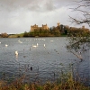
47 Linlithgow Loch
48 Tailend Moss by Bathgate
49 Longridge Moss west of Stoneyburn in the Breich Valley
47. Linlithgow Loch48. Tailend Moss by Bathgate49. Longridge Moss, west of Stoneyburn
50 Easter Inch Moss between Blackburn and Seafield
51 Calderwood within the Almondell and Calderwood Country Park
 
50. Easter Inch Moss51. Calderwood within the Almondell and Calderwood Country Park52. Shale Trail (opens new window)