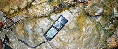
16. Society Shore at Hopetoun near South Queensferry
Good examples of local sandstone and limestone layers, and a Stigmaria root fossil near to Hopetoun House.

A Stigmaria fossil of the root system, or underground branching system, of a tree of the Carboniferous swamp forests, can be seen in a beach outcrop of the limestone. A good example of the use of local stone can also be seen here where the outcrop of sandstone dips to the east under a boundary wall. The wall is made of this sandstone and so blends well with the natural outcrop.
The shoreline from Society East Shore westwards to Abercorn Point (sites 14-18) displays a reasonably well exposed, gently-folded section of rocks from the middle part of the Carboniferous Period (around 330 million years ago). Sixteen individual exposures have been recorded within this section. Society East Shore is part of the Hopetoun Foreshore Geology Walk and a separate leaflet is available: Hopetoun Foreshore Geology Walk (PDF, 559 KB)(opens new window).
The site is close to Hopetoun House and parking is available at the small rural car park east of Society Cottages at Society Point. The area is accessible from minor roads and by National Cycle Route 76 that goes around the Firth. There is public transport to South Queensferry and Dalmeny Station, with a walk of 3-4 km along quiet roads. Nearby sites are Society East Shore (14), Society Point (15) and Hopetoun Shore (17).


