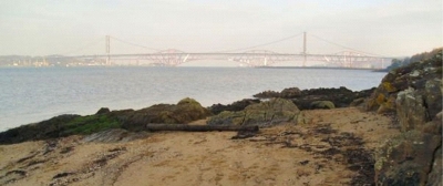
14. Society East Shore at Hopetoun near South Queensferry
Situated north-east of Hopetoun House, this is an interesting shoreline displaying several geological formations. This site includes the Burdiehouse Limestone which, unusually, was deposited in fresh water.

Society East Shore is a beautiful foreshore site, one of several on the south side of the Firth of Forth with views of the Forth Bridges. The rocks exposed on the foreshore include the Burdiehouse Limestone (this is an unusual limestone layer formed early in the Carboniferous Period in freshwater conditions, and it is found in various locations across the Lothian area) and mudstone, cut by a 'sandstone dyke' - where liquidised sand has been mobilised and injected into the original mud. A prominent sandstone layer overlies a thin oil-shale.
The shoreline from Society East Shore westwards to Abercorn Point (sites 14-18) displays a reasonably well exposed, gently-folded section of rocks from the middle part of the Carboniferous Period (around 330 million years ago). Sixteen individual exposures have been recorded within this section. Society East Shore is part of the Hopetoun Foreshore Geology Walk and a separate leaflet is available: Hopetoun Foreshore Geology Walk (PDF, 559 KB)(opens new window).
The site is close to Hopetoun House, and parking is available at the small rural car park east of Society Cottages at Society Point. The area is accessible from minor roads and by National Cycle Route 76 that goes around the Firth. There is public transport to South Queensferry and Dalmeny Station, with a walk of 3-4 km along quiet roads. Nearby sites are Hopetoun Obelisk Quarry (13), Society Point (15) and Society Shore (16).


