37. Linhouse Water (Near the Edinburgh-Shotts rail line Viaduct)
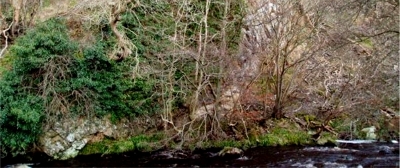
The Dalmahoy Sill forms a cliff above the Linhouse Water and a distinct ridge in the hillside above.

The Linhouse Water rises in the Pentland Hills and flows north, passing through the Crosswood Reservoir, to merge with the River Almond east of Livingston. The Dalmahoy Sill is well-exposed in the north-east bank of the Linhouse Water, around 200 metres upstream from the railway viaduct east of Oakbank. The sill forms a prominent cliff above the river and a distinct ridge in the hillside above.
The site can be reached by parking off the A71 or in Almondell Country Park or at Calderwood. Linhouse Water is part of Calderwood SSSI, designated for fen areas in the valley floor and upland oak woodland. Nearby geodiversity sites are in Murieston Water (9) and further along Linhouse Water (45).


